Welcome to T-MEDNet Marine Heatwave Tracker at 4 km in Near Real Time.
Powered by @nat_bensoussan & ICM-CSIC.
FOR MORE INFORMATION
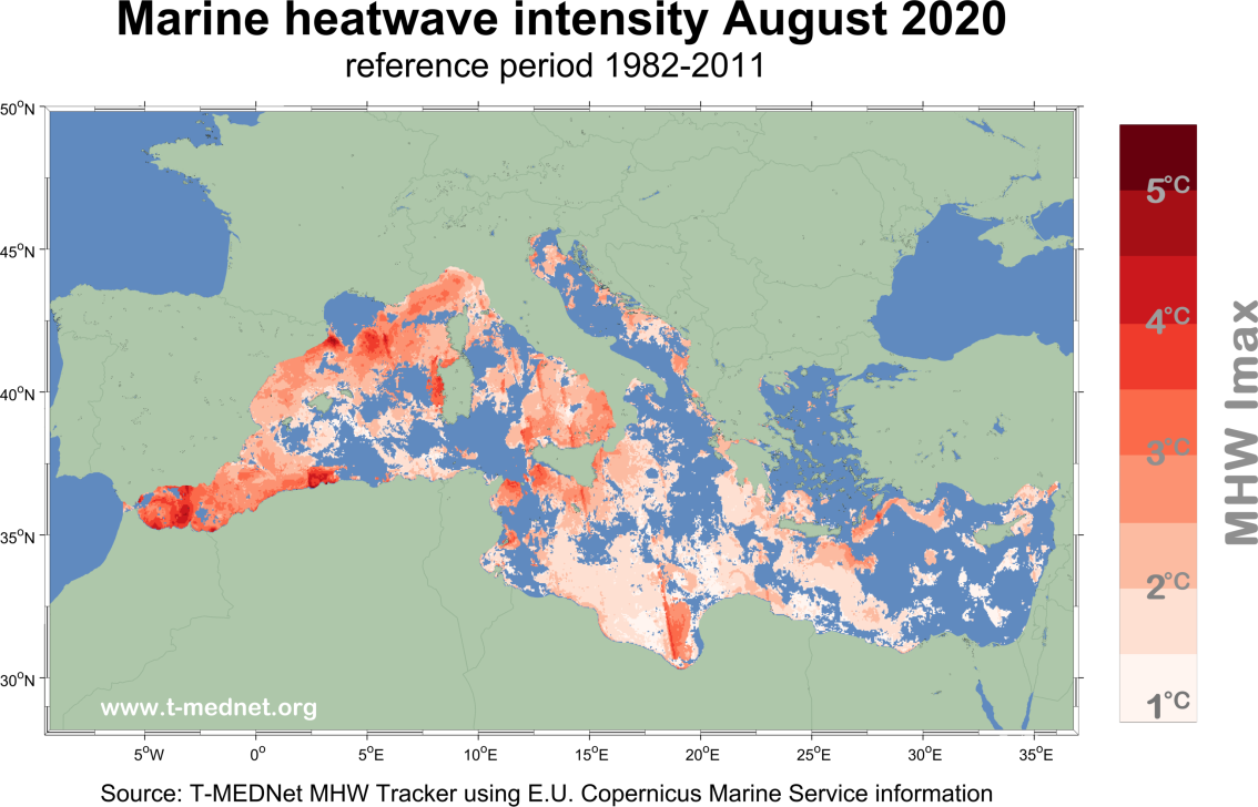
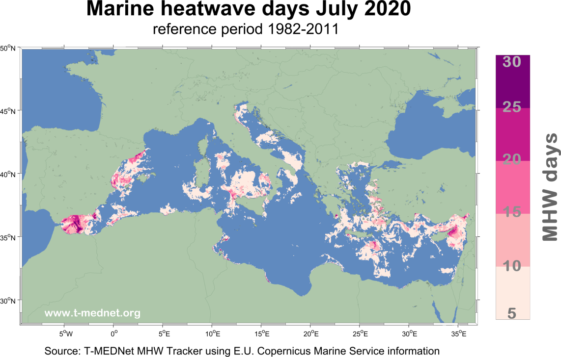
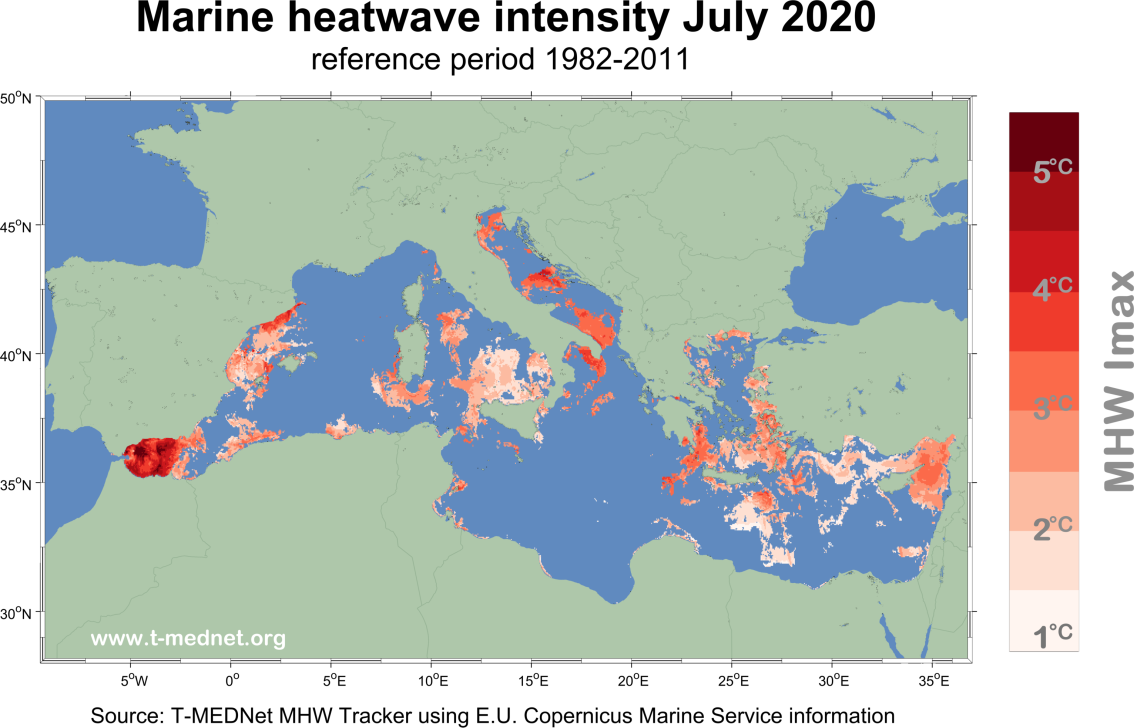
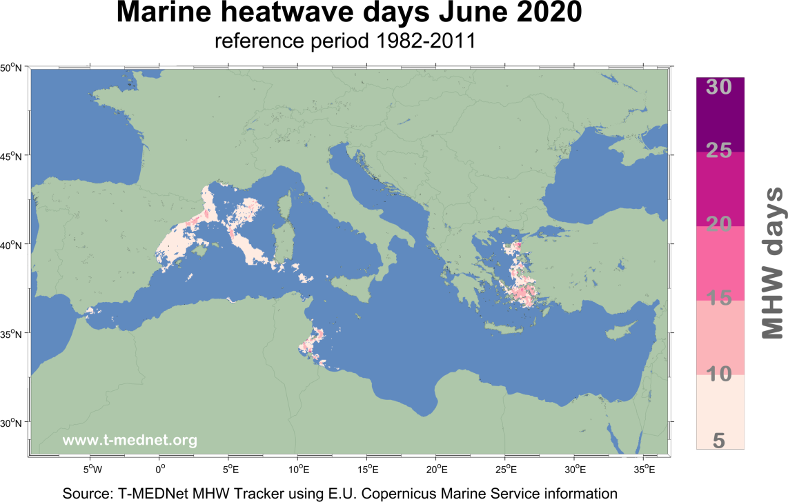
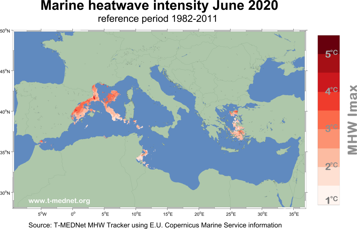
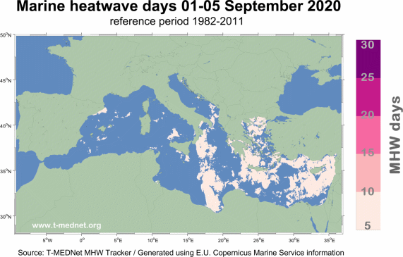
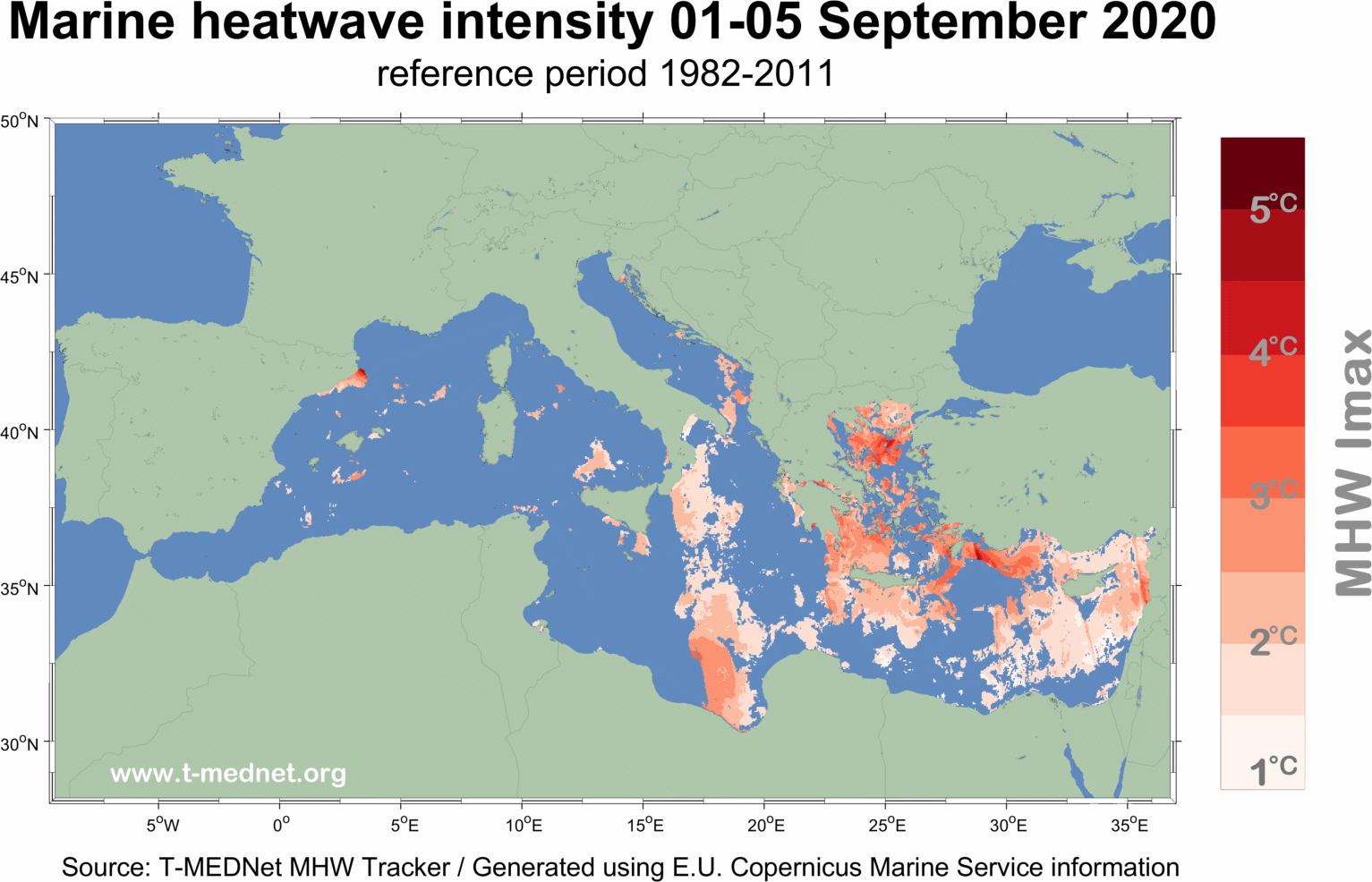
Extreme warming events known as Marine Heatwaves (MHW) have increased in frequency and magnitude worldwide, with harmful impacts on coastal ecosystems and human activities (e.g. Frolicher et al., 2018; Oliver et al., 2018; Smale et al., 2019). In the Mediterranean Sea, the rapid sea surface warming trend has been associated to strong increase in Marine Heatwave days, particularily during the past two decades (OSR#3 summary, Bensoussan et al., 2019ab).
In late July, early August and during September, large scale Marine Heatwave events have occurred over the Mediterranean Sea. This page is intended to share updated information with Mediterranean Marine Protected Areas managers, marine stakeholders and the general interested public.
Given the need for high-resolution information over the Mediterranean basin and coastal zone, satellite derived Sea Surface Temperature (SST) has been evaluated to track Mediterranean Marine Heatwaves in Near Real Time (NRT). A multi-products approach has been set up, in which NRT Optimally Interpolated daily SST maps from CMEMS are bias corrected and compared to long-term statistics calculated over the 1982-2011 period at 4 Km horizontal resolution. Marine Heatwave events characterization has been conducted using the approach of Hobdayet al. (2016, 2018) to evaluate their duration, intensity and allow comparison across spatial and temporal scales (e.g. www.marineheatwaves.org/tracker.html). All figures were generated using E.U Copernicus Marine Service Information. Powered by @nat_bensoussan & ICM-CSIC.
MHW MAPS in NRT
Started in June - last update 30/09/2020
MONTHLY MAPS